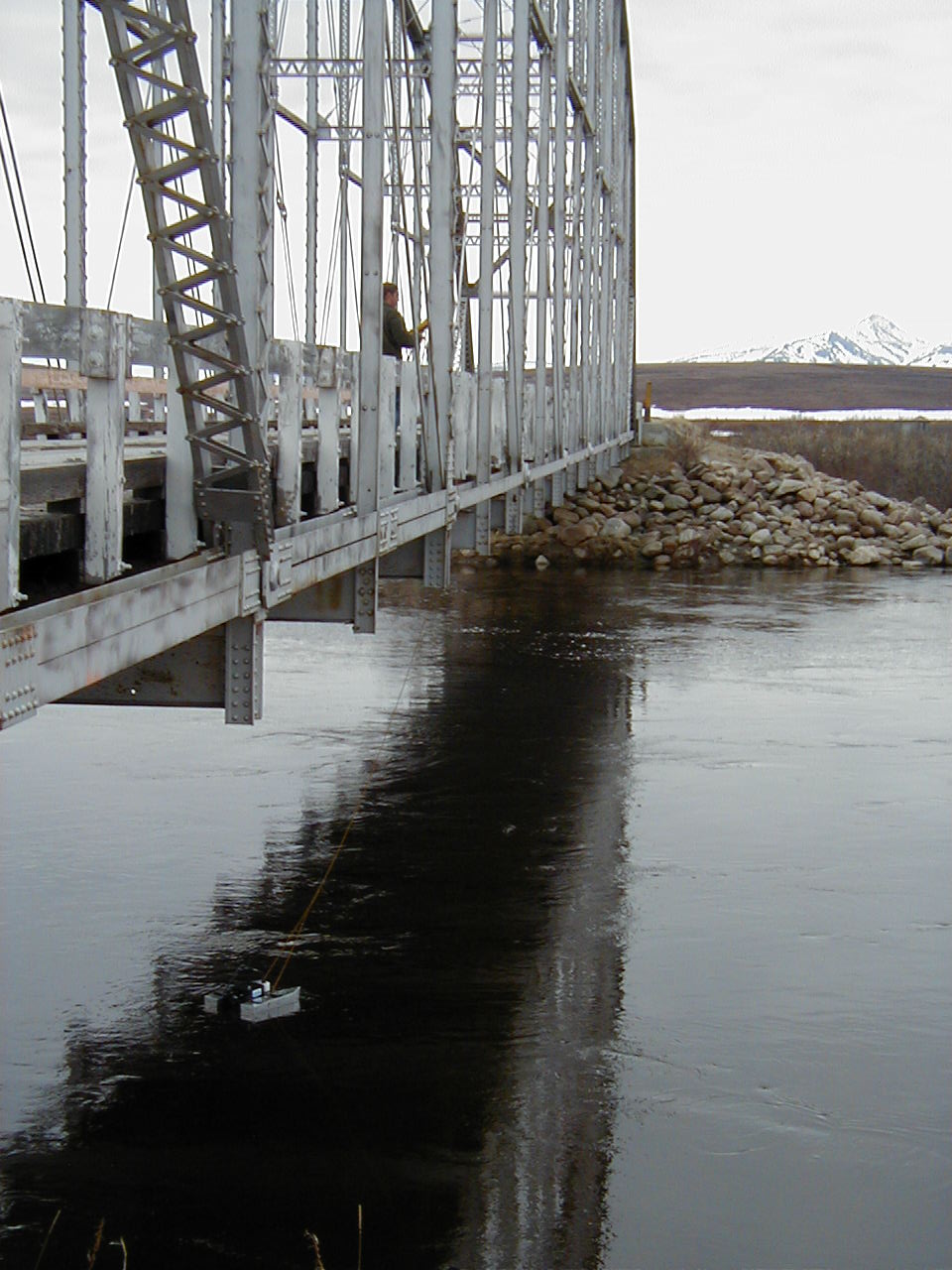
The next morning Bob and I head out in our truck on one of the old mining roads. About an hour and a half up the road we stop at the
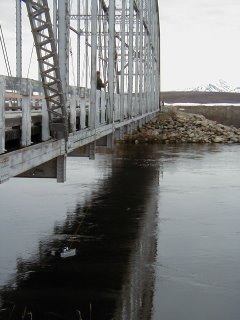
Kuzitrin River to gauge it and service the met station. The bridge over this river used to be the
Cushman street bridge over the Chena in
Fairbanks. When
Fairbanks remodeled they shipped it up north and put it here. Probably one of the few
Alaska recycling projects that worked out.
I should also mention that Nome is packed this time of year with the subspecies known as Homo Birdwatcherous. They made up most of our flight over here and can be spotted a mile away. Light rain jackets, homemade knit hats, wire glasses, binoculars around their necks at all times, camera tripods, folding chairs, and of course, bird books. Homo Birdwatcherous also travels in pairs, typically in their late 50s-late 60s. Often from Michigan. Anyway, as the birds come north, so to the birdwatchers and these peacenik versions of fishing hobbiests are the source of much fun-making by the locals, probably because they don’t kill anything.
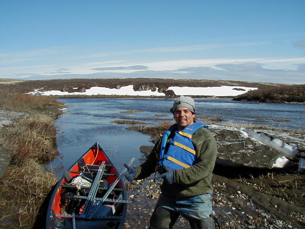
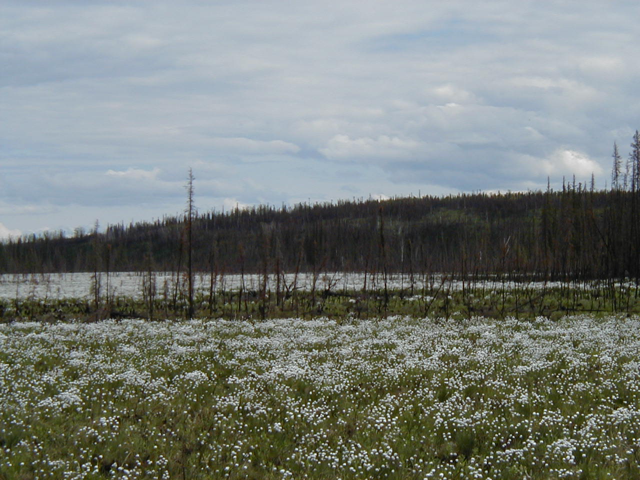
The Kuzitrin River has birds all over it. I don’t know any of their names, but there are small ones which make tweety noises, medium-sized ones which make sorrowful wails, and big geese which honk like taxis. Bob and I measure the speed of the river with an Acoustic Doppler Profiler called a Rivercat. Bob puts on his waders, straps a car battery on his back and wades out to the met station. Like the previous one, this tower is a couple feet underwater and only the instrument box is dry. I hang back and watch for moose and bears. Most of my job on this trip is to make sure bob doesn’t drown or get attacked by an animal. Though I’m familiar with most of the equipment, I have little to offer Bob; he’s a capable technician. I try to provide cheerful company at least.
Next we make our way up the mining road to a base camp called Quartz Creek. This is a small, unheated building next to a bush air strip and a couple of comex/semi-trailers/containers (these seem to be called something different in every part of the world). We unload our gear and supplies into the building. We pull the 4-wheeler out of the container and fill it with fuel. The engine won’t turn over, so we jump it with another battery we have.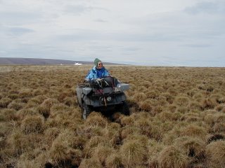
Bob shows me how the controls work and sends me out on the air strip to learn how to drive it and charge up the battery. Meanwhile he packs for our trip out to a couple more met stations. Driving the ATV is a lot more fun than I expected. I “tear it” down the gravel runway for a while, then head back to where Bob is waiting. We bungee a Rubbermaid lid to the cargo rack where is says “No passengers” and strap our equipment and bear spray on the front. I hop on the cargo rack and Bob says, “Hold on!”
The road goes another mile or so past this camp, but we turn off earlier onto the tussock tundra. The first few hundred meters are muddy as hell and we get the 4-wheeler stuck a couple of times. Then the mud subsides to tussock that burned recently leaving isolated 10 inch tall mounds of grass separated by little moats of marshy tundra. Each wheel on the ATV must climb each of these little grass islands between squishing through the tiny moats. It’s slow going with the ATV lurching back and forth, occasionally threatening to flip over.
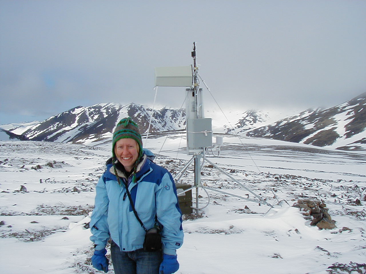
After 20 minutes of this from the vantage point of the cargo rack, I’m fairly sure my spine has dislocated, so I jump off and walk in the direction Bob says the met station should be. Hiking through the burned tussocks is nearly as bad; the mounds are not sturdy enough to support my weight, so my ankle just rolls off of them. The mini-moats between them seem better, but they are too narrow, so my boots get caught and I stumble every few feet. Despite the challenge of the tussocks, crossing 3 foot snow drifts, and wading through willow swamps, Bob only beats me to the station by a few minutes. He downloads the data while I attach a radiometer and we are both dive-bombed by the enormous early season mosquitos.
For the second station I decide the cargo rack on the ATV is the better option and suggest to Bob that NSF acquisition a monster truck for this job. Or a trail pony. I find the most comfortable position I can and concentrate on looking for bears as we negotiate a 2 mile trek, tussock by tussock. The second station we arrive at has been mauled by a bear. The precipitation gauge has been crushed, as if the bear sat on it. The animal then crawled up the tower, took a bite out of the windmill-shaped anemometer and bent over the temperature/humidity gauge. Finally to add insult to injury, the bear crapped all over the station. Sheesh.
We re-assembled and McGuyvered the instruments as best we could. By the time we headed back to our camp, everything was back to working except the half-eaten anemometer and we’d installed a radiometer. It felt great to get out of the cold, make dinner, and crawl into bed. By this time it was 1 am. One problem with Arctic fieldwork in the summer is that you are never constrained by the sun, only your own energy.
 The trip up was pretty cool. I took a van driven by a friend of mine, Alice, who has driven the haul road between Fairbanks and Prudhoe for 11 years. She knows every trucker and every tree on that road. We'd be driving in the middle of nowhere and she'd pull out the CB radio to check to see if Jack or Jerry was home. We stopped in Coldfoot to drop off some folks at the airfield. They were going to be flown into someplace for a week of hiking. Man, some people just can't get far enough away from themselves. Sheesh. This is already 6-hours north of Fairbanks. The coolest thing in Coldfoot was that a couple of kids had a lemonade stand on the airfield. How cute is that?
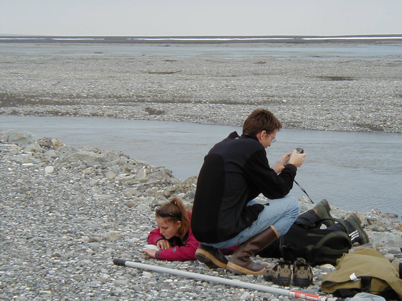

 There was still ice on the lake when I got there and a few days later it was almost gone. The loons are the most famous bird on this little lake, but there were also swans swimming in the open water. Very peaceful.